Dependable Erection

Wednesday, October 14, 2009

Ass-backwards

There's an AP article this morning talking about the town of Albert Lea, MN, where apparently many of the residents have collectively gone on a diet and exercise kick. Kids are walking to school, adults are walking to work, etc.

How?
With organizers' help, the city crammed five years of sidewalk and bike trail construction into a year to make exercise easier for its 18,000 residents.

Durham still hasn't met the promises of the 1996 sidewalk bond, and every new sidewalk project has to be monitored closely by its advocates to make sure it doesn't slip off the schedule and get pushed into the next budget cycle.

Backwards way of doing the city's business, if you ask me.

Labels: ,


Continue reading Ass-backwards

Monday, December 01, 2008

DPAC

So everyone who i know who was at last night's premiere performance at the Durham Performing Arts Center had a good time. Of course, everyone i know who went sat in the orchestra, so i don't have any first hand feedback on what those second balcony seats felt like.

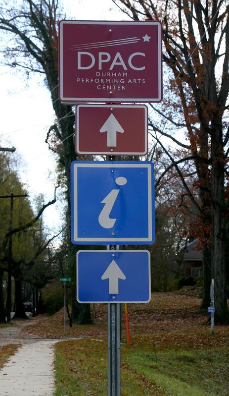
And i haven't had a chance to talk to any out of town guests who might have followed the new signs through my neighborhood to the DPAC.

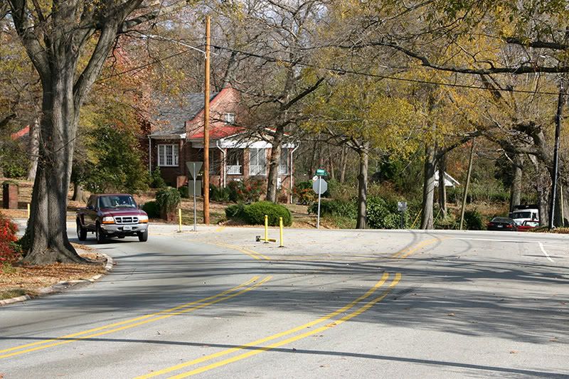
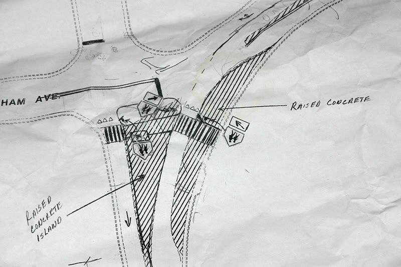
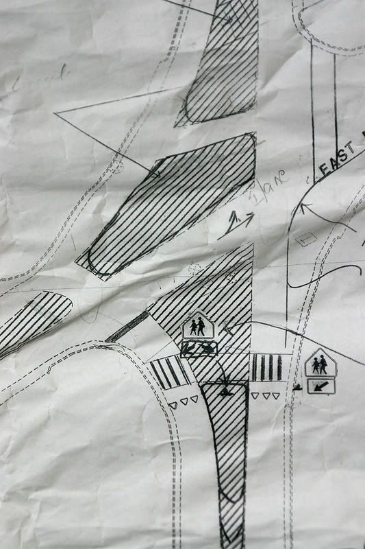
As i've been trying to point out to our City Council for the past couple of years, this route to the new Arts Center runs right through what city traffic engineers have called "possibly the worst designed intersection in the state," namely the Roxboro, Markham, Mangum crossover.


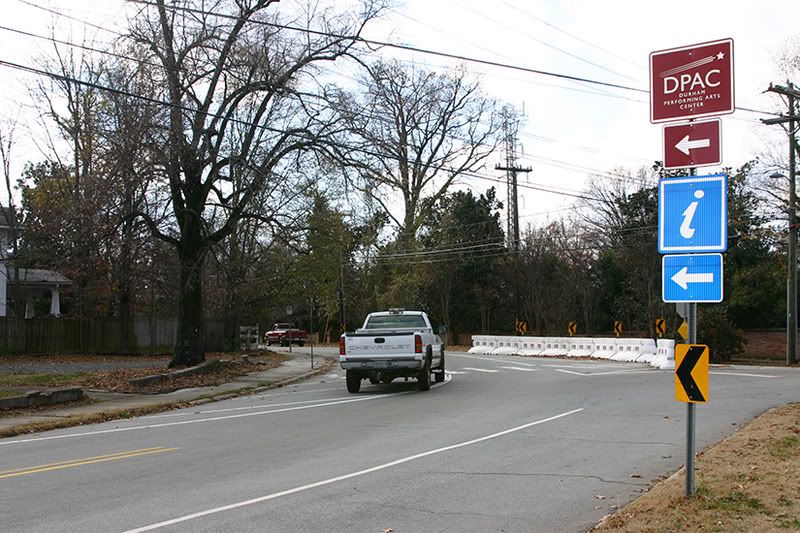
Now that we're inviting people from northern Wake County to come into our fair city from I-85 along Roxboro St., maybe now's a good time to think about redesigning this calamity with a little bit more than paint and construction grade Rhino barriers.

Those water filled plastic walls went up as a temporary measure ("one year, two years tops") until a permanent redesign could be installed. And it's not just to please our visitors' aesthetic senses that this needs to happen. If you live north and east of this intersection, walking to points south and west is just damn life threatening. (I'll be featuring the north west corner of Roxboro and Markham in an upcoming episode of "Curb cuts to nowhere." and fully 50 % of all traffic drives right through the painted "pedestrian safety zone" on the Mangum curve, as shown above.)

All of this wouldn't be so bad if city staff and the neighborhood association hadn't been talking about how to get this done, oh, 7 freaking years ago.


As far as i can tell, our City Council will continue to forget that this has ever been discussed with the Neighborhood Association until they either suddenly receive 500 emails reminding them, or someone gets killed trying to walk across this intersection.

Let's hope it's the former. You can write to all seven members of Council with one email at Council@durham.ci.nc.us.

While you're at it, maybe you can remind them that, despite the lovely crosswalk and signal lights that have been installed across Roxboro at the entrance to the nicest playground in the city, virtually no one driving on Roxboro ever actually yields to anyone who's walking through the intersection with, say, a baby stroller, or toddlers in tow. And forget about letting your 9 year old cross that street alone. It's not as though there's any evidence out there that the simple act of walking more might be an effective tool in the fight against childhood obesity.

And as an aside, this sure as hell isn't going to help enhance anyone's perception of downtown Durham, is it?

Labels: , ,


Continue reading DPAC

Tuesday, July 22, 2008

What should a library look like?

Durham wants your opionions:
The Durham County Library will host a public meeting from 5:30-7 p.m. July 29 to solicit public input on the renovation of its Main Library branch at 300 N. Roxboro St.

The public is invited to share their ideas and to hear a presentation from the project architects Chris Brasier and Bill Ash of SmithGroup, Ed Lazaron of Design Collaborative and Jeffrey Scherer of Meyer, Scherer & Rockcastle as part of the Main Library Planning and Programming Study.

"The planning study has two parts," said Library Director Skip Auld. "First, SmithGroup's mechanical and structural engineers will evaluate the existing building. We know it has 'good bones,' now we want to learn all about 'the good, the bad, and the ugly' of our Main Library."

The second part of the study is program planning to determine what the community wants in a new library and to identify square footage, equipment needs and costs associated with each program element.

Gary probably has some good ideas. For me, having a front door that works, and isn't hidden behind a couple of hundred feet of lawn would be a start.

Labels: ,


Continue reading What should a library look like?

Tuesday, May 13, 2008

Walking Brooklyn


I mentioned yesterday that my walk through Brooklyn on Saturday was a much calmer event than most of my walks through Durham. Here's what i'm thinking.

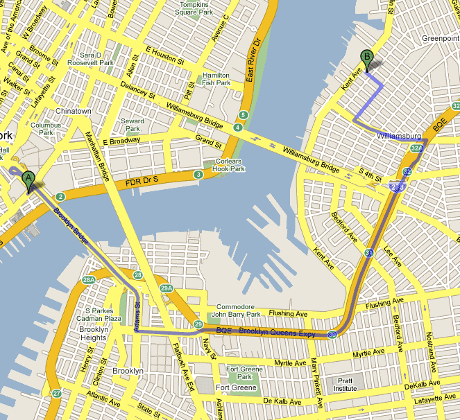
As the comedian Steven Wright once said, "any place is walking distance if you have enough time." And we had plenty of time. We started out around 10 am on Pearl St. in lower Manhattan, and walked across the Brooklyn Bridge. The Bridge itself is about 3/4 mile long; add in the pedestrian access areas, and you're talking between a mile and a mile and quarter. Google puts the whole trip by car at about 5.3 miles; figure on foot all together it was about 5 miles total.

First, entering and exiting the bridge on foot felt completely safe. The sidewalks started and ended where you expected them to, and the walkway across the bridge was separated from vehicular traffic. Compare that to the bridge across I-85 at Duke Street, for example, or crossing I-40 on foot near Southpoint. Both of those are shorter walks than the one across the East River that thousands of people make every day. But the feeling that you are taking your life in your hands to walk across either of those keeps the number of pedestrians down in the single or low double digits on a daily basis.

Our walk varied from the route highlighted on the map. We crossed under the BQE (I-278) at Navy St., turned right on Flushing Ave. and walked along the old Navy Yards, crossed under the BQE again near Kent St., turned left on Bedford, and followed Bedford all the way to N. 8th St. We crossed under the BQE a 4th time on Bedford (at the "31" marker), and also crossed under the Williamsburg Bridge overpass. As you can see from the pictures in the post below, it's not the most beautiful walk i've ever taken. It's all concrete, chain link fences, and a sense of aging. Leaving out, of course, the hole in the space-time continuum that is Williamsburg from roughly Hewes St. to Division Ave. To walk those blocks on a Saturday morning is, literally, to enter a time and place so different from any other in the United States as to defy description. Details in the comments if you want them.

But, getting back to more, ahem, pedestrian concerns, even crossing under the Expressway and bridge overpasses four or five times never felt dark or threatening. There were other people out walking, even in the most abandoned feeling blocks. Cars drove the speed limit (30 mph), yielded to pedestrians at crosswalks. At one point, a driver turned and was headed the wrong way on one-way Bedford Ave. At first, a few people waved to call his attention to the fact. When he ignored them and continued driving the wrong way, the mood changed from concern to anger, and people stepped in front of the car to get him turned around before anyone got hurt. I guess he was only going a few blocks and didn't want to make the big loop.

The biggest difference between Brooklyn and Durham, though, was the noise. Figure roughly 200 to 250 cars passed on surface streets during our two and a half hour walk. That doesn't include cars on the Expressway, obviously. That's a far lower number than would pass during a walk from, say I-85 to Brightleaf Square along Gregson or Duke. And of those, only one was playing a sound system loud enough to be heard on the sidewalk, fifteen feet away. Just one. On an average Sunday afternoon, if i'm in my backyard 100 feet from Avondale Drive, i can count between 15 and 20 times an hour that sound systems loud enough to rattle my windows drive by. Hell, some of these are loud enough than i can hear them over my lawnmower while i'm cutting what remains of the grass in the back yard. Why is it that Durham can't figure out how to minimize this problem?

As nice as it might be, i don't expect to see the kind of change here that i saw on Bedford Ave., which, when i lived on N. 8th St. in the 80s had a couple of pizza places and convenience stores, and now has, between Division Ave. and N. 11th St., about 30 sidewalk cafes, sushi, Thai, fusion, eclectic restaurants, a couple of bars, real estate offices, and, believe it or not, two apparently thriving record stores selling CDs and music. I know the population density in Durham isn't high enough to support that kind of commerce. But really, can't we figure out a way to encourage people in cars to drive the speed limit, respect people who are not in cars, and consider that not everyone in the entire city is interested in hiring them as a DJ at any point in time?

Is that really so hard?

(Oh, by the way, brunch at Juliette's for the four of us, including 7 bloody mary's, came to well under a hundred bucks with tax. Some of the on-line reviews for this place have been less than kind, but i'll say that our service was impeccable, and the banana-stuffed French toast was superb.)

Labels: ,


Continue reading Walking Brooklyn

Friday, June 29, 2007

Blazing a trail, or "This is a nice place"

This is a tale of a trail. the tale has a beginning and a middle, but is still waiting for an ending. I tell it to this point in the hope that its authors come up with a better ending than the one it looks like they're writing.

Once upon a time, I-85 was a four lane highway through north Durham. Recognizing that projected traffic volumes would overflow a road of that size, the NCDOT developed a plan to widen the highway to 4 (or 5, or 6, depending on the exact location) lanes in each direction through the urban part of town, roughly exits 173 through 178. A small neighborhood road called Brookline Drive ran just south of the highway at about mile marker 176. It was a little neighborhood shortcut between Acadia Street and Washington Street, and although a few people missed it when it went away as part of the widening project, it wasn't a major loss.

In fact, the NCDOT promised to convert Brookline to a walking trail between Duke Park on the East, and the South Ellerbe Creek trail, which has a trailhead at the intersection of Club Blvd. and Washington.

The trail isn't exactly finished, but it's opened, and i took a walk on it the other night.

Here's a bit of what i found.
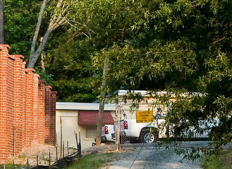


For starters, the trail doesn't extend into Duke Park, but actually terminates at the end of Acadia St. That's not necessarily a bad thing, but it really would be nice if there was a trailhead in the park. There's a lovely ravine at the east end of Duke Park which could, with a bit of imagination and money, be a small nature preserve. There's red-tail hawks nesting there, and some native flora that i'm not expert enough to identify. That would make a nice spur off the Ellerbe Trail.
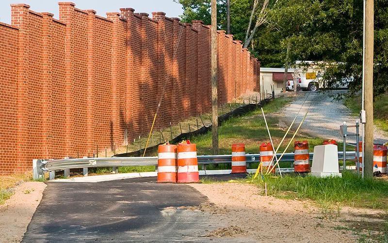

Down at the Acadia St. entrance, there's a few orange barrels, but no gate or bollard systm to prevent motor vehicles from entering the trail. It's possbile that those are set to be installed at some future date.
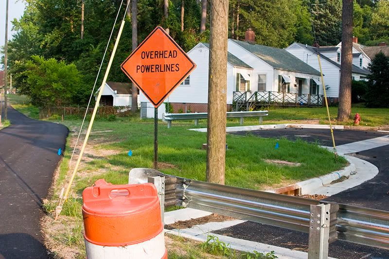

But after looking at the guard rail system that's been installed at the foot of Glendale (above), you have to wonder. The little turnout in the middle right of the photo really has nothing in place to prevent a car or pickup truck from driving over the curb onto the paved trail. And don't think that people won't be doing just that.
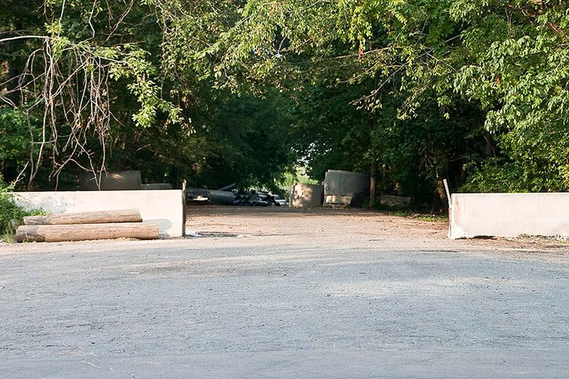

Things are no better at the Washington St. end of the trail, which is wide open to vehicles of any size. And given the recent headlines and listserv posts about thefts of storm drain gratings and manhole covers, that's a pretty big oversight.


There's some other problems with the Washington St. terminus of the new trail. It too, doesn't really connect with anything. The trailhead for the South Ellerbe Creek trail is on the other side of Washington, about 100 or so yards north. Which means you've either got to dash across Washington where you come out of the trail, or head north on the shoulderless and sidewalk free road itself. Washington, as those of you who drive on it or live near it know, is absurdly wide for a two lane road, nearly 55 feet across. Northbound traffic is coming around a blind curve if you're thinking of crossing there. Southbound traffic has often accelerated to make the light at Club, and seeing cars go by at 50 mph or so is not uncommon. There's a patch of woods north of the old Brookline right of way that the trail could still be constructed on, which would put you much closer to the Ellerbe Creek trail, and let you cross Washington at the signalized intersection without having to walk unprotected on the road.


On the trail itself, there are some more issues. The sound wall does a surprisingly good job of minimizing traffic noise. But it's construction has created some potential erosion problems which it doesn't look like NCDOT's planting program is going to solve. Look for washouts behind the concrete retaining wall, and especially in the area where the retaining wall ends.
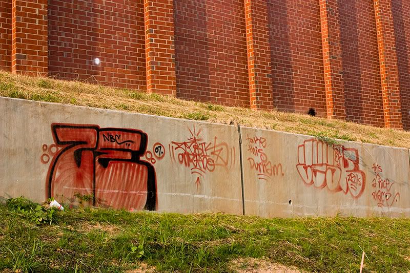


And speaking of the retaining wall, well, what do you expect when you put a blank canvas up in such an out of the way, yet easily accessible place? It's taken multiple phone calls to the city this week to explain exactly where this graffiti is located, and to determine who has jurisdiction over cleaning it up. the area is still, to my knowledge, NCDOT right of way. It may actually make sense in the long term to call it a freedom of expression zone, and encourage the creation of art, because otherwise, the city is going to be cleaning up graffiti at this location on a pretty regular basis.
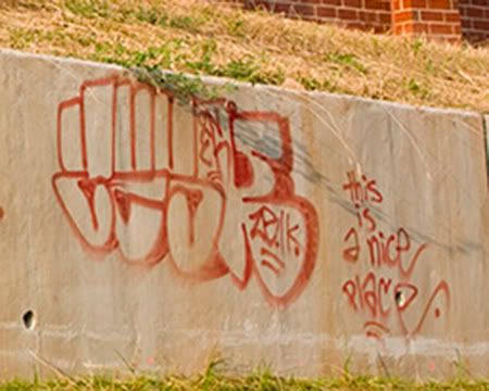

As the sign says, this is a nice place.

UPDATE: Graffiti had been removed by end of day Friday.

Labels: , ,


Continue reading Blazing a trail, or "This is a nice place"