

Raynor and Holloway
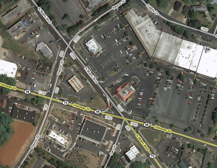
I stopped by the intersection of Raynor and Holloway yesterday for a first hand look at the "scene of the crime." Raynor, Holloway, and Miami Blvd converge in this area to make one rather large commercial district, with a strip mall (that has one of the few grocery stores in East Durham), a ton of fast food restaurants, a drug store, and a couple of auto parts stores. All 1.8 miles or so from City Hall.
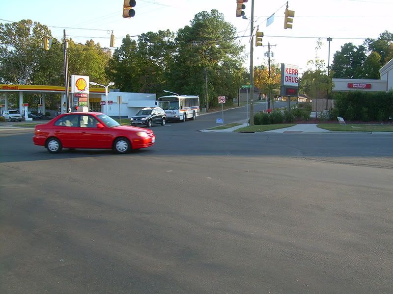
Looking south/southwest across Holloway to Raynor. There's a painted crosswalk on Raynor, south of Holloway. It's the only crosswalk in the entire section of the map above.

Looking west across down Holloway across Raynor. There are curb cuts at all the intersections, and a sidewalk along the south side of Holloway, but no crosswalks or "Walk" signs.
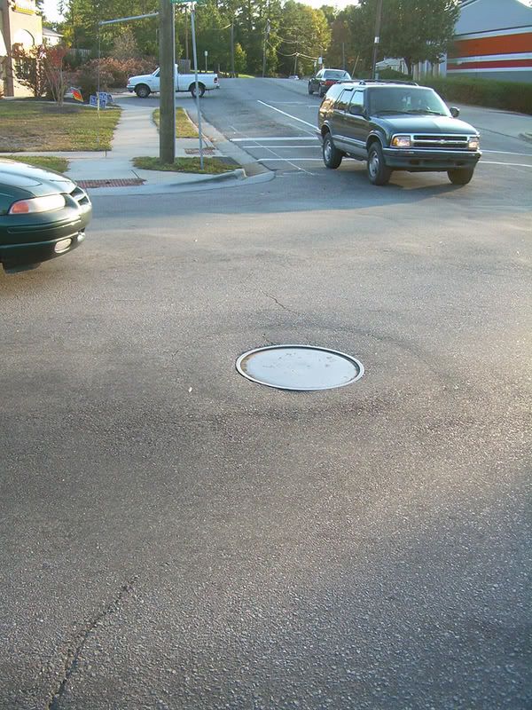
South across Holloway to Raynor. Is there a stop line on westbound Holloway? If there is, that car is well past it. Again, curb cut for wheelchair access, but no crosswalk.
South/southeast down Miami across Holloway. Sidewalks and curb cuts, but no crosswalks or pedestrian signals.
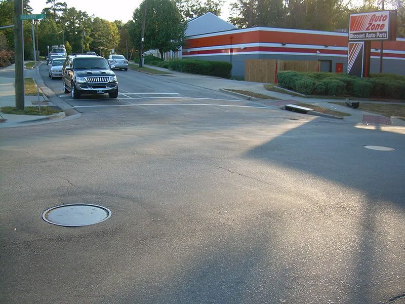
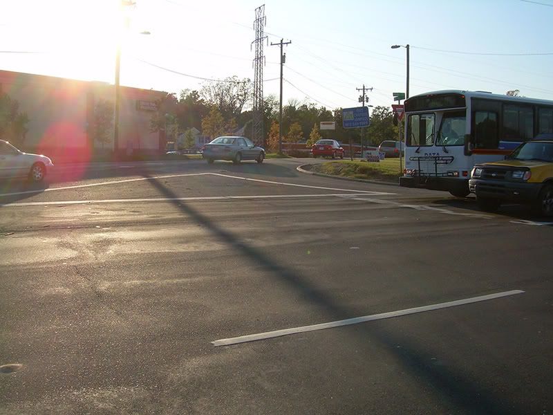
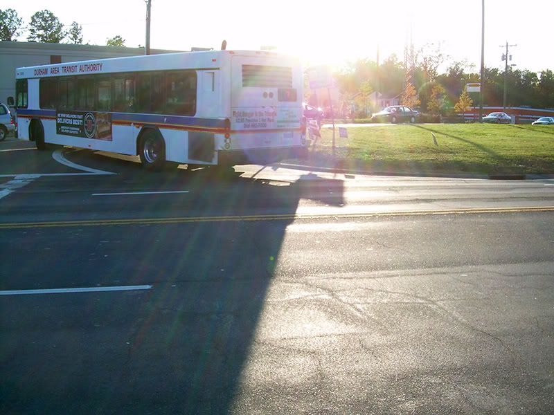
South across Miami and Holloway to Gary St., where the bus is coming up. That's a pretty vast sea of asphalt to get across, isn't it? Again, curb cuts for wheelchair access, but no crosswalks or indication that a pedestrian or someone in a wheelchair has any business being on this street.
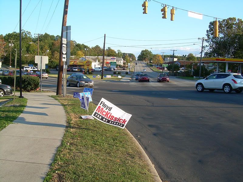
Looking west on Holloway across Miami. I have no idea where you would cross this street.
A few steps further north on Miami than the last picture. Again, no way to get across Miami on foot or wheelchair over here.
Take a look at that map again. There's a lot of people living, working, and shopping in this commercial and residential district. There should be a whole lot more foot traffic around here. (There should be more people shopping at the grocery store than grabbing a delayed heart attack at the McDonald's as well, but that's a different, although related, problem.) Holloway Street is also known as NC 98, so i'd assume it's a state maintained road. I'm guessing that Miami Blvd, which turns into US 70 about a mile or so to the south, is also a state maintained road. NCDOT has demonstrated time and again that it's main concern is moving as many vehicles from point A to point B in the least amount of time as possible. I've spoken with some engineers and planners at NCDOT who would dispute this, and who seem to know the vocabulary, at least, of pedestrian safety issues and planning for walkable communities. But when the rubber hits the road, this is what we always end up with. Large swaths of asphalt, and people in the hospital, or the funeral home.
Some folks in the city's transportation department have a better understanding of how to do this right. Unfortunately, when it comes to places like this, they've got virtually no say.
Looking south/southwest across Holloway to Raynor. There's a painted crosswalk on Raynor, south of Holloway. It's the only crosswalk in the entire section of the map above.
Looking west across down Holloway across Raynor. There are curb cuts at all the intersections, and a sidewalk along the south side of Holloway, but no crosswalks or "Walk" signs.
South across Holloway to Raynor. Is there a stop line on westbound Holloway? If there is, that car is well past it. Again, curb cut for wheelchair access, but no crosswalk.
South/southeast down Miami across Holloway. Sidewalks and curb cuts, but no crosswalks or pedestrian signals.
South across Miami and Holloway to Gary St., where the bus is coming up. That's a pretty vast sea of asphalt to get across, isn't it? Again, curb cuts for wheelchair access, but no crosswalks or indication that a pedestrian or someone in a wheelchair has any business being on this street.
Looking west on Holloway across Miami. I have no idea where you would cross this street.
A few steps further north on Miami than the last picture. Again, no way to get across Miami on foot or wheelchair over here.
Take a look at that map again. There's a lot of people living, working, and shopping in this commercial and residential district. There should be a whole lot more foot traffic around here. (There should be more people shopping at the grocery store than grabbing a delayed heart attack at the McDonald's as well, but that's a different, although related, problem.) Holloway Street is also known as NC 98, so i'd assume it's a state maintained road. I'm guessing that Miami Blvd, which turns into US 70 about a mile or so to the south, is also a state maintained road. NCDOT has demonstrated time and again that it's main concern is moving as many vehicles from point A to point B in the least amount of time as possible. I've spoken with some engineers and planners at NCDOT who would dispute this, and who seem to know the vocabulary, at least, of pedestrian safety issues and planning for walkable communities. But when the rubber hits the road, this is what we always end up with. Large swaths of asphalt, and people in the hospital, or the funeral home.
Some folks in the city's transportation department have a better understanding of how to do this right. Unfortunately, when it comes to places like this, they've got virtually no say.
Labels: NCDOT, Pedestrian safety
 Since 1949, Durhamites have slept soundly, secure in the knowledge that, in our town, erection can be depended upon. Now, thanks to the power of the internets, we can spread that security all over the world.

0 Comments:
Post a Comment
<< Home